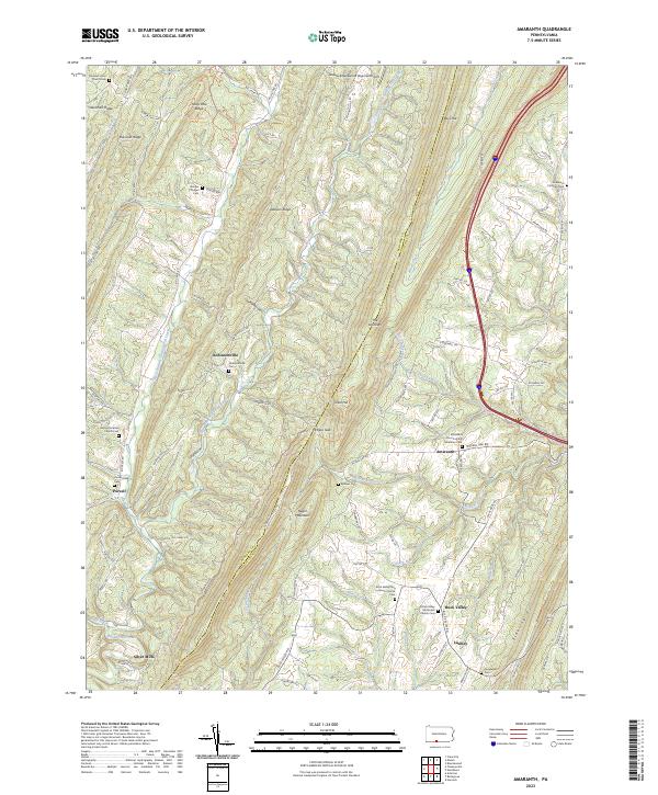
2023 Map of Amaranth
USGS Topo · Published 2023About this map
Negro Mountain and Town Hill form a steep, parallel ridge system through this portion of the Pennsylvania highlands, shaping the settlement patterns of rural Fulton and Bedford counties. Small agricultural communities such as Robinsonville, Silver Mills, and Buck Valley are tucked into the narrow valleys, connected by winding routes like Robinsonville Rd and Amaranth Rd. The landscape is notably defined by its many rural congregations and burial grounds, including the Amaranth Church of the Brethren and the Buck Valley Zion Lutheran Church. These institutions serve as anchors for the scattered hamlets along the creeks. The drainage network is complex, with the West Branch Sideling Hill Creek and East Branch Sideling Hill Creek carving through the ridges, while the Greater Breezewood Regional Airport occupies a rare level stretch of high ground in the north.
Find a feature on this map
94 named features on this map. Tap any name to fly to it.
Don’t see what you’re looking for? This feature index may not catch every label — zoom into the map to look around manually.
Map Details
Editions of this 2023 Amaranth Map
This is the sole edition of this map. No revisions or reprints were ever made.
Other maps of this area

1898 · Paw Paw
USGS Topo · 1:62,500

1899 · Hancock
USGS Topo · 1:62,500

1900 · Pawpaw
USGS Topo · 1:62,500

1901 · Hancock
USGS Topo · 1:62,500

1910 · Paw Paw
USGS Topo · 1:62,500

1925 · Needmore
USGS Topo · 1:48,000

1927 · Clearville
USGS Topo · 1:48,000

1931 · Clearville
USGS Topo · 1:62,500

1935 · Needmore
USGS Topo · 1:62,500

1939 · Needmore
USGS Topo · 1:62,500
Featured Places
- Monroe Township, PA
- Brush Creek Township, PA
- Amaranth, Union Township
- Lashley, Union Township
- Point View, Union Township