
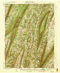
1939 Map of Needmore
USGS Topo · Published 1939About this map
Scrub Ridge and Meadow Ground Mountain dominate the central topography of this 1930s landscape, where a dense network of valley settlements follows the winding paths of Licking Creek and Tonoloway Creek. The area reflects a classic Ridge-and-Valley agricultural pattern, punctuated by small country landmarks like Hamiltons Store and the industrial presence of the Big Cove Tannery. Genealogists will find a wealth of local history in the numerous rural institutions, from McNaughton Sch and Compulsion Sch to numerous houses of worship such as Bethlehem Ch and Pleasant Grove Ch. The presence of Anthony Ford and narrow mountain passages like Daves Gap and Deneen Gap reveal the historical transit routes used by residents of Needmore and Warfordsburg before modern infrastructure fully reshaped the region.
Find a feature on this map
84 named features on this map. Tap any name to fly to it.
Don’t see what you’re looking for? This feature index may not catch every label — zoom into the map to look around manually.
Map Details
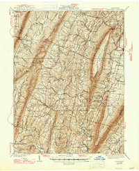
Editions of this 1939 Needmore Map
Other maps of this area

1898 · Paw Paw
USGS Topo · 1:62,500

1899 · Hancock
USGS Topo · 1:62,500

1900 · Pawpaw
USGS Topo · 1:62,500

1900 · Mercersburg
USGS Topo · 1:62,500

1900 · Everett
USGS Topo · 1:62,500

1901 · Hancock
USGS Topo · 1:62,500

1902 · Everett
USGS Topo · 1:62,500

1902 · Mercersburg
USGS Topo · 1:62,500

1910 · Paw Paw
USGS Topo · 1:62,500

1912 · Williamsport
USGS Topo · 1:62,500
Featured Places
- Ayr Township, PA
- Andover, Licking Creek Township
- Bethel Township, PA
- Gapsville, East Providence Township
- Todd Township, PA