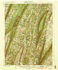
1939 Map of Needmore
USGS Topo · Published 1939About this map
Mcconnellsburg and the surrounding townships of Belfast, Bethel, and Thompson form the core of this late-1930s survey, revealing a landscape defined by sharp mountain ridges and tightly packed rural infrastructure. The mapping captures a network of country schools like Compulsion Sch and Siloam Sch alongside numerous small congregations such as Sideling Hill Ch and Ebenezer Ch. The drainage of Licking Creek and Tonoloway Creek dictates the placement of early industry and commerce, from the Big Cove Tannery to Sines Mill. Local commerce is further evidenced by Hannans Store, while the Wink Cem and various family-named features like McKendree Ch offer specific points of interest for genealogists tracing ancestors through this section of Fulton County. The terrain is dominated by north-south elevations including Sideling Hill and Scrub Ridge, which channeled travel into gaps such as Betsey Gap and Daves Gap.
Find a feature on this map
96 named features on this map. Tap any name to fly to it.
Don’t see what you’re looking for? This feature index may not catch every label — zoom into the map to look around manually.
Map Details
Editions of this 1939 Needmore Map

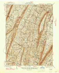
Other maps of this area

1898 · Paw Paw
USGS Topo · 1:62,500

1899 · Hancock
USGS Topo · 1:62,500

1900 · Pawpaw
USGS Topo · 1:62,500

1900 · Mercersburg
USGS Topo · 1:62,500

1900 · Everett
USGS Topo · 1:62,500

1901 · Hancock
USGS Topo · 1:62,500

1902 · Everett
USGS Topo · 1:62,500

1902 · Mercersburg
USGS Topo · 1:62,500

1910 · Paw Paw
USGS Topo · 1:62,500

1912 · Williamsport
USGS Topo · 1:62,500
Featured Places
- Ayr Township, PA
- Andover, Licking Creek Township
- Bethel Township, PA
- Gapsville, East Providence Township
- Todd Township, PA