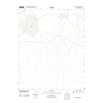
2012 Map of Amargosa Flat
USGS Topo · Published 2012About this map
Crystal occupies the northeastern corner of this desert landscape, characterized by a grid of streets with equestrian-themed names. The layout of Bronco Way, Mustang Ln, Bridle Way, and Appaloosa Ln suggests a community oriented toward ranching or rural living on the edge of the basin. To the west, the prominent white expanse of the Amargosa Flat dominates the topography, a dry lake bed indicative of the arid hydrography of Nye County. The map traces the essential transit corridors that connect this isolated settlement to the broader region, most notably the path of Crystal Rd and the diagonally-reaching Devils Hole Rd. While the southern and central portions of the sheet remain largely open terrain marked by intermittent drainage patterns, the clustered developments in the north represent the primary human footprint in this corner of the Mojave.
Find a feature on this map
11 named features on this map. Tap any name to fly to it.
Don’t see what you’re looking for? This feature index may not catch every label — zoom into the map to look around manually.
Map Details
Editions of this 2012 Amargosa Flat Map
This is the sole edition of this map. No revisions or reprints were ever made.
Other maps of this area

1908 · Furnace Creek
USGS Topo · 1:250,000

1910 · Furnace Creek
USGS Topo · 1:250,000

1942 · Skull Mountain
USGS Topo · 1:125,000

1948 · Death Valley
USGS Topo · 1:250,000

1952 · Ash Meadows
USGS Topo · 1:62,500

1952 · Specter Range
USGS Topo · 1:62,500

1954 · Death Valley
USGS Topo · 1:250,000

1956 · Death Valley
USGS Topo · 1:250,000

1957 · Death Valley
USGS Topo · 1:250,000

1958 · Death Valley
USGS Topo · 1:250,000