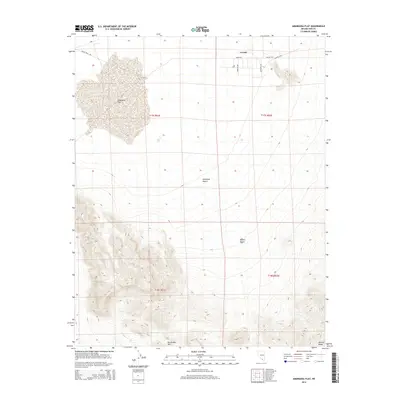
2014 Map of Amargosa Flat
USGS Topo · Published 2014About this map
Crystal sits at the northern edge of this arid Nevada landscape, where the local road network including Ranch Rd and Crystal Hwy serves a small cluster of desert residences. The terrain is dominated by the broad, low-lying Amargosa Flat and the surrounding reaches of the Amargosa Desert, which transitions into the northern Mojave Desert to the south. This 2014 survey reveals the stark geography of the Devils Hole Hills and the rising elevations of the Johnnie Range in the southeastern corner. The grid-like organization of public lands is clearly marked by township and range lines, such as t17s r51e, illustrating how human infrastructure like Devils Hole Rd and Appaloosa Ln has been etched into this expansive basin-and-range environment.
Find a feature on this map
16 named features on this map. Tap any name to fly to it.
Don’t see what you’re looking for? This feature index may not catch every label — zoom into the map to look around manually.
Map Details
Editions of this 2014 Amargosa Flat Map
This is the sole edition of this map. No revisions or reprints were ever made.
Other maps of this area

1908 · Furnace Creek
USGS Topo · 1:250,000

1910 · Furnace Creek
USGS Topo · 1:250,000

1942 · Skull Mountain
USGS Topo · 1:125,000

1948 · Death Valley
USGS Topo · 1:250,000

1952 · Ash Meadows
USGS Topo · 1:62,500

1952 · Specter Range
USGS Topo · 1:62,500

1954 · Death Valley
USGS Topo · 1:250,000

1956 · Death Valley
USGS Topo · 1:250,000

1957 · Death Valley
USGS Topo · 1:250,000

1958 · Death Valley
USGS Topo · 1:250,000