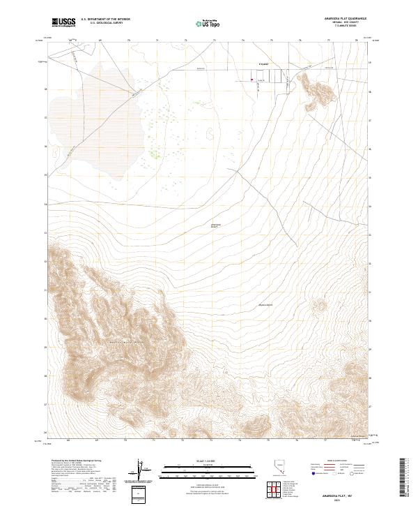
2021 Map of Amargosa Flat
USGS Topo · Published 2021About this map
The settlement of Crystal occupies the northern reaches of this desert landscape, where the Amargosa Desert meets the Mojave Desert. The topography is dominated by the sharp elevations of the Devils Hole Hills in the southwest and the western edges of the Johnnie Range in the southeast. This 2021 survey shows a sparse but deliberate network of local access roads serving the area around Crystal, including Clark Dr, Bronco Way, and Appaloosa Ln. The primary transit corridor is the Crystal Hwy, while the southern half of the map remains largely undeveloped terrain defined by steep contours and alluvial flats. For those tracing land use in Nye County, the map provides precise township and range demarcations such as t17s r51e and t18s r52e, which help pin the relationship between the small residential cluster and the surrounding protected desert lands.
Find a feature on this map
16 named features on this map. Tap any name to fly to it.
Don’t see what you’re looking for? This feature index may not catch every label — zoom into the map to look around manually.
Map Details
Editions of this 2021 Amargosa Flat Map
This is the sole edition of this map. No revisions or reprints were ever made.
Other maps of this area

1908 · Furnace Creek
USGS Topo · 1:250,000

1910 · Furnace Creek
USGS Topo · 1:250,000

1942 · Skull Mountain
USGS Topo · 1:125,000

1948 · Death Valley
USGS Topo · 1:250,000

1952 · Ash Meadows
USGS Topo · 1:62,500

1952 · Specter Range
USGS Topo · 1:62,500

1954 · Death Valley
USGS Topo · 1:250,000

1956 · Death Valley
USGS Topo · 1:250,000

1957 · Death Valley
USGS Topo · 1:250,000

1958 · Death Valley
USGS Topo · 1:250,000