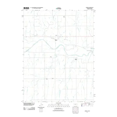
2011 Map of Amboy
USGS Topo · Published 2011About this map
The Republican River winds through this rural landscape on the border of Nebraska and Kansas, anchoring a network of agricultural and historic sites. The area around Amboy and Lester Junction is defined by its water management systems, notably the Franklin Canal and the Superior-Courtland Dam which regulates the river flow near Pawnee Lake. This 2011 survey provides significant detail for genealogists, identifying several burial grounds including Pleasant Hill Cemetery, Martin Cemetery, and Wagoner Cemetery. A distinct bend in the river near Pawnee Village highlights the historical significance of this terrain, where tributary systems like Willow Creek, Elm Creek, and Hicks Creek converge toward the Republican valley. The presence of The Island and numerous named creeks illustrates the complex drainage patterns that have shaped local settlement and land use for generations.
Find a feature on this map
20 named features on this map. Tap any name to fly to it.
Don’t see what you’re looking for? This feature index may not catch every label — zoom into the map to look around manually.
Map Details
Editions of this 2011 Amboy Map
This is the sole edition of this map. No revisions or reprints were ever made.
Other maps of this area

1893 · Smith Center
USGS Topo · 1:125,000

1894 · Mankato
USGS Topo · 1:125,000

1897 · Red Cloud
USGS Topo · 1:125,000

1898 · Superior
USGS Topo · 1:125,000

1940 · Red Cloud
USGS Topo · 1:62,500

1942 · Red Cloud
USGS Topo · 1:62,500

1955 · Grand Island
USGS Topo · 1:250,000

1955 · Beloit
USGS Topo · 1:250,000

1957 · Grand Island
USGS Topo · 1:250,000

1958 · Grand Island
USGS Topo · 1:250,000