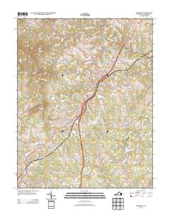
2013 Map of Amherst
USGS Topo · Published 2013About this map
Amherst serves as the central hub of this 2013 landscape, where the Blue Ridge foothills transition into a network of small residential clusters and agricultural holdings. The map illustrates a developed corridor following the local transportation routes, connecting the town with outlying settlements such as Sardis, Monitor, and Buffalo Hill. To the south, the influence of the nearby college is evident near Sweet Briar Station and the recreational waters of Sweetbriar Lake.
Find a feature on this map
140 named features on this map. Tap any name to fly to it.
Don’t see what you’re looking for? This feature index may not catch every label — zoom into the map to look around manually.
Map Details
Editions of this 2013 Amherst Map
This is the sole edition of this map. No revisions or reprints were ever made.
Other maps of this area

1892 · Lynchburg
USGS Topo · 1:125,000

1892 · Buckingham
USGS Topo · 1:125,000

1892 · Appomattox
USGS Topo · 1:125,000

1894 · Lexington
USGS Topo · 1:125,000

1935 · Amherst
USGS Topo · 1:48,000

1939 · Amherst
USGS Topo · 1:62,500

1944 · Lynchburg
USGS Topo · 1:62,500

1947 · Roanoke
USGS Topo · 1:250,000

1950 · Amherst
USGS Topo · 1:62,500

1950 · Lynchburg
USGS Topo · 1:62,500