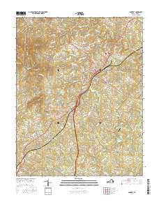
2016 Map of Amherst
USGS Topo · Published 2016About this map
Amherst serves as the central hub of this Central Virginia landscape, situated where the terrain transitions from the elevations of Richardson Mtn and Kentucky Mtn in the west toward the Buffalo River valley in the northeast. The cultural footprint of the region is defined by longstanding institutions and small rural crossroads. The campus of Sweet Briar Coll dominates the central portion of the map, neighbored by the Sweet Briar Station locale.
Find a feature on this map
140 named features on this map. Tap any name to fly to it.
Don’t see what you’re looking for? This feature index may not catch every label — zoom into the map to look around manually.
Map Details
Editions of this 2016 Amherst Map
This is the sole edition of this map. No revisions or reprints were ever made.
Other maps of this area

1892 · Lynchburg
USGS Topo · 1:125,000

1892 · Buckingham
USGS Topo · 1:125,000

1892 · Appomattox
USGS Topo · 1:125,000

1894 · Lexington
USGS Topo · 1:125,000

1935 · Amherst
USGS Topo · 1:48,000

1939 · Amherst
USGS Topo · 1:62,500

1944 · Lynchburg
USGS Topo · 1:62,500

1947 · Roanoke
USGS Topo · 1:250,000

1950 · Amherst
USGS Topo · 1:62,500

1950 · Lynchburg
USGS Topo · 1:62,500