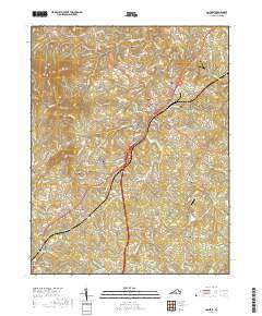
2019 Map of Amherst
USGS Topo · Published 2019About this map
Amherst serves as the central hub of this Virginia landscape, anchored by the Amherst County Courthouse and a dense network of local roads that branch out toward the surrounding foothills. To the south, the expansive grounds of Sweet Briar College and Sweetbriar Lake define the terrain, while the former Sweet Briar Station points to the area's rail history along the main corridor. The topography is shaped by prominent peaks such as Richardson Mtn and Strode Mtn, with the Buffalo River and Huff Cr carving through the northern sections.
Find a feature on this map
151 named features on this map. Tap any name to fly to it.
Don’t see what you’re looking for? This feature index may not catch every label — zoom into the map to look around manually.
Map Details
Editions of this 2019 Amherst Map
This is the sole edition of this map. No revisions or reprints were ever made.
Other maps of this area

1892 · Lynchburg
USGS Topo · 1:125,000

1892 · Buckingham
USGS Topo · 1:125,000

1892 · Appomattox
USGS Topo · 1:125,000

1894 · Lexington
USGS Topo · 1:125,000

1935 · Amherst
USGS Topo · 1:48,000

1939 · Amherst
USGS Topo · 1:62,500

1944 · Lynchburg
USGS Topo · 1:62,500

1947 · Roanoke
USGS Topo · 1:250,000

1950 · Amherst
USGS Topo · 1:62,500

1950 · Lynchburg
USGS Topo · 1:62,500