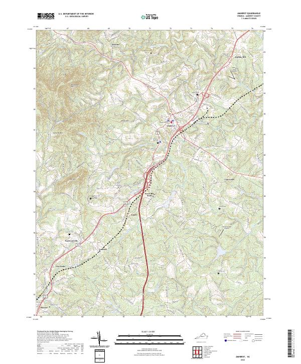
2022 Map of Amherst
USGS Topo · Published 2022About this map
Amherst serves as the focal point of this central Virginia landscape, anchored by the Amherst County Courthouse and its surrounding network of historic cemeteries like Amherst Cem and Christian Aid Cem. To the south, the academic grounds of Sweet Briar College dominate the terrain, featuring landmarks such as Monument Hill at Sweet Briar and the nearby Sweet Briar Station. The topography is defined by significant rises including Buffalo Hill, Richardson Mtn, and Kentucky Mtn, which overlook the winding paths of the Buffalo River and Higginbotham Cr.
Find a feature on this map
150 named features on this map. Tap any name to fly to it.
Don’t see what you’re looking for? This feature index may not catch every label — zoom into the map to look around manually.
Map Details
Editions of this 2022 Amherst Map
This is the sole edition of this map. No revisions or reprints were ever made.
Historical Maps of Angelo Through Time
6 maps found