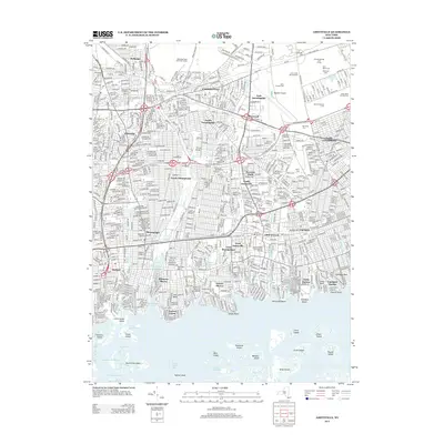
2013 Map of Amityville
USGS Topo · Published 2013About this map
Republic Airport stands as a central landmark in this densely developed corridor of Long Island, where suburban growth meets significant aerospace and recreational infrastructure. The map illustrates the transition from the bustling streets of Farmingdale and Amityville to the complex wetlands of the south shore. A massive concentration of memorial grounds, including New Montefiore Cem and the Cem of the Resurrection, dominates the landscape near East Farmingdale. Along the waterfront, the intricate network of canals and inlets at Biltmore Shores and Copiague Harbor reveals the region's marine character. Extensive island chains like Squaw Island and Gilgo Island separate the mainland from the Great South Bay, showing the delicate balance of coastal geography and the Long Island rail-dependent development that shaped these communities.
Find a feature on this map
73 named features on this map. Tap any name to fly to it.
Don’t see what you’re looking for? This feature index may not catch every label — zoom into the map to look around manually.
Map Details
Editions of this 2013 Amityville Map
This is the sole edition of this map. No revisions or reprints were ever made.
Other maps of this area

1897 · Hempstead
USGS Topo · 1:62,500

1897 · Oyster Bay
USGS Topo · 1:62,500

1898 · Hempstead
USGS Topo · 1:62,500

1898 · Oyster Bay
USGS Topo · 1:62,500

1899 · Hempstead
USGS Topo · 1:62,500

1900 · Oyster Bay
USGS Topo · 1:62,500

1901 · Babylon
USGS Topo · 1:62,500

1901 · Northport
USGS Topo · 1:62,500

1903 · Babylon
USGS Topo · 1:62,500

1903 · Northport
USGS Topo · 1:62,500