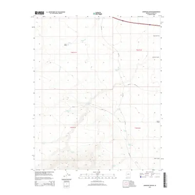
2014 Map of Anderson Canyon
USGS Topo · Published 2014About this map
Anderson Canyon and its surrounding high-desert plateau dominate this Coconino County landscape, where water management is the defining human footprint. The map documents an extensive network of stock tanks and catchments, such as Charlebois Tanks, Lute Hart Tank, and Big Anderson Tank, which support ranching in an arid environment where permanent water is scarce. Many of these features carry family names, providing a clear record of local land use and grazing history.
Find a feature on this map
26 named features on this map. Tap any name to fly to it.
Don’t see what you’re looking for? This feature index may not catch every label — zoom into the map to look around manually.
Map Details
Editions of this 2014 Anderson Canyon Map
This is the sole edition of this map. No revisions or reprints were ever made.
Other maps of this area

1886 · San Francisco Mtns
USGS Topo · 1:250,000

1887 · Verde
USGS Topo · 1:250,000

1891 · San Francisco Mtns
USGS Topo · 1:250,000

1892 · Verde
USGS Topo · 1:250,000

1894 · San Francisco Mtns
USGS Topo · 1:250,000

1899 · San Francisco Mtns
USGS Topo · 1:250,000

1947 · Flagstaff
USGS Topo · 1:250,000

1954 · Flagstaff
USGS Topo · 1:250,000

1954 · Holbrook
USGS Topo · 1:250,000

1957 · Holbrook
USGS Topo · 1:250,000