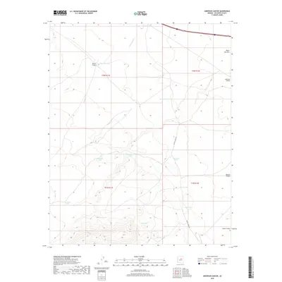
2018 Map of Anderson Canyon
USGS Topo · Published 2018About this map
Babbitt Wash and its associated water management features define this high-desert landscape in Coconino County. The map documents an extensive network of named tanks and dams essential for livestock and local land use, including Golden Dam Tank, Big Anderson Tank, and the Boyd-Reid Tank. These artificial water sources are strategically placed near natural drainage systems like Elliott Canyon and Anderson Canyon, highlighting the historical necessity of water catchment in this arid region.
Find a feature on this map
23 named features on this map. Tap any name to fly to it.
Don’t see what you’re looking for? This feature index may not catch every label — zoom into the map to look around manually.
Map Details
Editions of this 2018 Anderson Canyon Map
This is the sole edition of this map. No revisions or reprints were ever made.
Other maps of this area

1886 · San Francisco Mtns
USGS Topo · 1:250,000

1887 · Verde
USGS Topo · 1:250,000

1891 · San Francisco Mtns
USGS Topo · 1:250,000

1892 · Verde
USGS Topo · 1:250,000

1894 · San Francisco Mtns
USGS Topo · 1:250,000

1899 · San Francisco Mtns
USGS Topo · 1:250,000

1947 · Flagstaff
USGS Topo · 1:250,000

1954 · Flagstaff
USGS Topo · 1:250,000

1954 · Holbrook
USGS Topo · 1:250,000

1957 · Holbrook
USGS Topo · 1:250,000