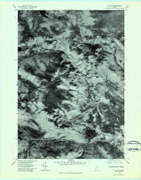
1977 Map of Andover
USGS Topo · Published 1983About this map
Andover sits at the base of a heavily forested landscape defined by steep peaks and drainage basins in this late-1970s orthophotoquad. The imagery reveals the distinct textures of Maine’s timberlands, from the dark stands of evergreens to the lighter patches that trace the winding course of Sawyer Brook and Black Brook. To the north, the shoreline of Lower Richardson Lake marks the edge of the wilderness, while Wyman Mountain dominates the central terrain with its high, textured ridges. The valley floor is carved by the West Branch Ellis River, providing a clear view of the relationship between the small village and the surrounding mountain water systems. This photographic survey offers researchers a precise look at land use and vegetation patterns before modern development, capturing the area around C Pond as it appeared decades ago.
Find a feature on this map
7 named features on this map. Tap any name to fly to it.
Don’t see what you’re looking for? This feature index may not catch every label — zoom into the map to look around manually.
Map Details
Editions of this 1977 Andover Map
This is the sole edition of this map. No revisions or reprints were ever made.
Other maps of this area

1927 · Rumford
USGS Topo · 1:48,000

1930 · Rumford
USGS Topo · 1:62,500

1933 · Rangeley
USGS Topo · 1:48,000

1939 · Rangeley
USGS Topo · 1:62,500

1940 · Oquossoc
USGS Topo · 1:62,500

1942 · Oquossoc
USGS Topo · 1:62,500

1943 · Old Speck Mtn
USGS Topo · 1:62,500

1945 · Old Speck Mtn
USGS Topo · 1:62,500

1949 · Rangeley
USGS Topo · 1:62,500

1950 · Lewiston
USGS Topo · 1:250,000
Featured Places
- Andover, ME
- Byron, ME
- Andover North Surplus Township, ME
- Andover West Surplus Township, ME
- Township C, ME