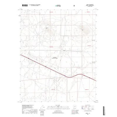
2018 Map of Angell
USGS Topo · Published 2018About this map
Rattlesnake Crater and Merrill Crater dominate the high desert terrain of the Coconino National Forest, illustrating the volcanic geology of this northern Arizona landscape. The small settlement of Angell serves as a central point in this sparsely populated area, which is primarily defined by the distribution of water resources such as Piper Tank, Colcord Tank, and Page Tank. These artificial catchments are critical infrastructure for land management and ranching within the forest boundaries.
Find a feature on this map
19 named features on this map. Tap any name to fly to it.
Don’t see what you’re looking for? This feature index may not catch every label — zoom into the map to look around manually.
Map Details
Editions of this 2018 Angell Map
This is the sole edition of this map. No revisions or reprints were ever made.
Other maps of this area

1886 · San Francisco Mtns
USGS Topo · 1:250,000

1891 · San Francisco Mtns
USGS Topo · 1:250,000

1894 · San Francisco Mtns
USGS Topo · 1:250,000

1899 · San Francisco Mtns
USGS Topo · 1:250,000

1947 · Flagstaff
USGS Topo · 1:250,000

1954 · Flagstaff
USGS Topo · 1:250,000

1958 · Flagstaff
USGS Topo · 1:250,000

1960 · Flagstaff
USGS Topo · 1:250,000

1962 · Flagstaff
USGS Topo · 1:250,000
1962 · Ashurst Lake
USGS Topo · 1:24,000