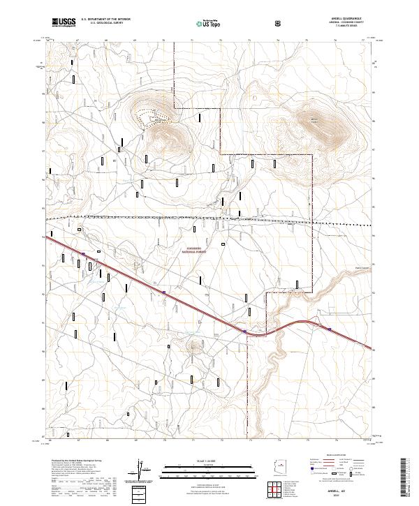
2021 Map of Angell
USGS Topo · Published 2021About this map
Volcanic landforms and deep canyons dominate this high-desert landscape within the Coconino National Forest. Distinctive geologic features like Rattlesnake Crater and Merrill Crater rise above the surrounding terrain, while Youngs Canyon and Padre Canyon cut through the arid surface. The small settlement of Angell serves as a primary point of human activity along the transcontinental rail corridor that traverses the central part of the sheet.
Find a feature on this map
17 named features on this map. Tap any name to fly to it.
Don’t see what you’re looking for? This feature index may not catch every label — zoom into the map to look around manually.
Map Details
Editions of this 2021 Angell Map
This is the sole edition of this map. No revisions or reprints were ever made.
Other maps of this area

1886 · San Francisco Mtns
USGS Topo · 1:250,000

1891 · San Francisco Mtns
USGS Topo · 1:250,000

1894 · San Francisco Mtns
USGS Topo · 1:250,000

1899 · San Francisco Mtns
USGS Topo · 1:250,000

1947 · Flagstaff
USGS Topo · 1:250,000

1954 · Flagstaff
USGS Topo · 1:250,000

1958 · Flagstaff
USGS Topo · 1:250,000

1960 · Flagstaff
USGS Topo · 1:250,000

1962 · Flagstaff
USGS Topo · 1:250,000
1962 · Ashurst Lake
USGS Topo · 1:24,000