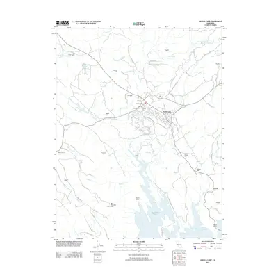
2012 Map of Angels Camp
USGS Topo · Published 2012About this map
Angels Camp and the neighboring community of Altaville serve as the focal points of this Calaveras County landscape, where gold-rush era history is written into the topography. The presence of multiple cemeteries, including the Altaville Protestant Cem, Lode Cem, Serbian Cem, and Catholic Cem, underscores the deep-rooted genealogical significance of this mining district. The terrain is marked by significant elevations like German Ridge and Bear Mountain, falling away to the expansive waters of the New Melones Reservoir.
Find a feature on this map
78 named features on this map. Tap any name to fly to it.
Don’t see what you’re looking for? This feature index may not catch every label — zoom into the map to look around manually.
Map Details
Editions of this 2012 Angels Camp Map
This is the sole edition of this map. No revisions or reprints were ever made.
Other maps of this area

1889 · Jackson
USGS Topo · 1:125,000

1891 · Big Trees
USGS Topo · 1:125,000

1892 · Jackson
USGS Topo · 1:125,000

1893 · Sonora
USGS Topo · 1:125,000

1894 · Big Trees
USGS Topo · 1:125,000

1896 · Sonora
USGS Topo · 1:125,000

1897 · Jackson
USGS Topo · 1:125,000

1897 · Sonora
USGS Topo · 1:125,000

1897 · Big Trees
USGS Topo · 1:125,000

1898 · Sonora
USGS Topo · 1:125,000