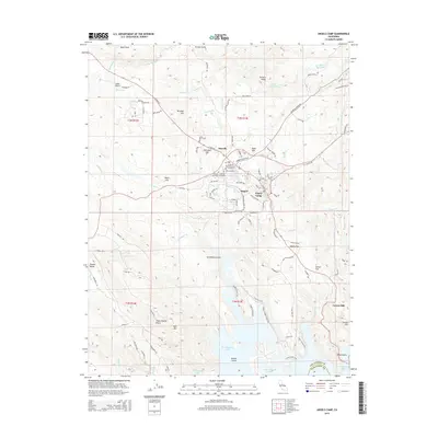
2015 Map of Angels Camp
USGS Topo · Published 2015About this map
Angels Camp and the historic settlement of Altaville anchor this study of the Gold Country interior, where the modern landscape of New Melones Lake meets the deep-rooted mining history of Calaveras County. The map provides an incredible concentration of genealogical data, centering on five distinct burial grounds including the Cherokee Flat Cemetery, Serbian Cemetery, and Altaville Protestant Cemetery. These sites, clustered near the junction of State Route 49, speak to the diverse immigrant communities that once worked the surrounding lodes. To the south, the terrain rises toward Carson Hill and Bear Mtn, overlooking the expansive waters of the reservoir. Traces of the region's hydraulic and hard-rock mining legacy remain visible through features like the Jupiter Ditch and Schmauder Mine Rd, which wind through the ridges near German Ridge and Greenhorn Gulch.
Find a feature on this map
107 named features on this map. Tap any name to fly to it.
Don’t see what you’re looking for? This feature index may not catch every label — zoom into the map to look around manually.
Map Details
Editions of this 2015 Angels Camp Map
This is the sole edition of this map. No revisions or reprints were ever made.
Other maps of this area

1889 · Jackson
USGS Topo · 1:125,000

1891 · Big Trees
USGS Topo · 1:125,000

1892 · Jackson
USGS Topo · 1:125,000

1893 · Sonora
USGS Topo · 1:125,000

1894 · Big Trees
USGS Topo · 1:125,000

1896 · Sonora
USGS Topo · 1:125,000

1897 · Jackson
USGS Topo · 1:125,000

1897 · Sonora
USGS Topo · 1:125,000

1897 · Big Trees
USGS Topo · 1:125,000

1898 · Sonora
USGS Topo · 1:125,000