Loading...
Loading map...2022 Map of Anna
USGS Topo · Published 2022About this map
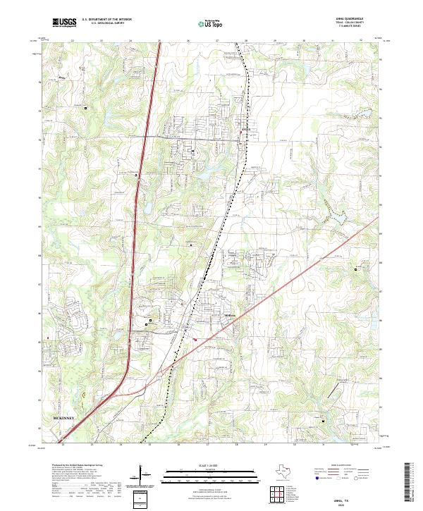
The growing community of Anna and the neighboring city of Melissa anchor this 2022 survey of northern Collin County. Situated along the corridor of Central Expressway, the landscape transitions from residential subdivisions to the agricultural reaches of the E Fork Trinity River basin. The area is characterized by several small watercourses, including Throckmorton Cr, Slaughter Cr, and Stiff Cr, which drain the undulating terrain towards the south and east.
Find a feature on this map
213 named features on this map. Tap any name to fly to it.
Don’t see what you’re looking for? This feature index may not catch every label — zoom into the map to look around manually.
Map Details
Date Portrayed2022
Date Published2022
PublisherU.S. Geological Survey
Map TypeTopographic
Scale1:24000
Physical Dimensions24 x 29 inches
Editions of this 2022 Anna Map
This is the sole edition of this map. No revisions or reprints were ever made.
Historical Maps of Kelly Through Time
Featured Locations
Source Details
SourceU.S. Geological Survey
CopyrightPublic Domain