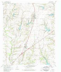
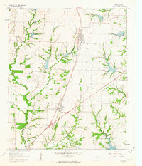
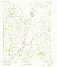
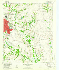
1961 Map of Anna
USGS Topo · Published 1985About this map
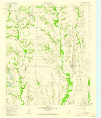
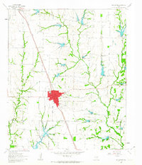
The Southern Pacific railroad corridor dictates the settlement pattern of this Collin County landscape, connecting the towns of Anna and Melissa. In this 1961 field-checked survey, these agricultural communities are surrounded by a dense network of family and community landmarks, including Lair Cem, Coffman Cem, and Highland Cem. The terrain is deeply etched by the East Fork Trinity River and its numerous tributaries like Hurricane Creek and Throckmorton Creek, which created the drainage patterns that influenced early property lines and road placements such as Old Telephone Road. Local industry and education are represented by the Quarry and Gravel Pits near the eastern boundary, and the Independent Sch at Melissa. This map captures the area before the significant suburban expansion of the Dallas-Fort Worth metroplex, showing a rural Texas economy still centered on the rails and the river forks.
Find a feature on this map
27 named features on this map. Tap any name to fly to it.
Don’t see what you’re looking for? This feature index may not catch every label — zoom into the map to look around manually.
Map Details
Editions of this 1961 Anna Map
3 editions found
Other maps of this area

1929 · McKinney
USGS Topo · 1:62,500

1930 · Farmersville
USGS Topo · 1:62,500

1954 · Sherman
USGS Topo · 1:250,000

1958 · Sherman
USGS Topo · 1:250,000
1960 · McKinney East
USGS Topo · 1:24,000
1960 · Blue Ridge
USGS Topo · 1:24,000
1960 · Culleoka
USGS Topo · 1:24,000
1960 · McKinney West
USGS Topo · 1:24,000
1961 · Gunter
USGS Topo · 1:24,000
1961 · Van Alstyne
USGS Topo · 1:24,000