
1930 Map of Farmersville
USGS Topo · Published 1930About this map
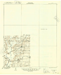
Nevada and Copeville anchor the eastern landscape of this early 20th-century Texas survey, situated along a vital transportation corridor where the ST Louis Southwestern and Gulf Colorado and Santa Fe railroads intersect. The topography is defined by the winding course of the East Fork Trinity River and its tributaries, including Pilot Grove Creek and Ticky Creek. This era of rural development is clearly visible through a dense network of local landmarks, from Bumpass Bridge spanning the creeks to a distribution of community schools like Cotton Belt Sch and Neathery Sch. A cluster of rural institutions, such as Shiloh Ch and Empire Sch, reflects the localized social structure of southeastern Collin County before the significant mid-century shifts in agriculture and settlement patterns.
Find a feature on this map
23 named features on this map. Tap any name to fly to it.
Don’t see what you’re looking for? This feature index may not catch every label — zoom into the map to look around manually.
Map Details
Editions of this 1930 Farmersville Map
2 editions found
Other maps of this area

1891 · Dallas
USGS Topo · 1:125,000

1893 · Dallas
USGS Topo · 1:125,000

1912 · Rockwall
USGS Topo · 1:31,680

1919 · Royse City
USGS Topo · 1:62,500

1924 · Farmersville 3-c
USGS Topo · 1:48,000

1924 · Mc Kinney 4-d
USGS Topo · 1:48,000

1929 · McKinney
USGS Topo · 1:62,500

1954 · Dallas
USGS Topo · 1:250,000

1954 · Sherman
USGS Topo · 1:250,000

1956 · Quinlan
USGS Topo · 1:62,500