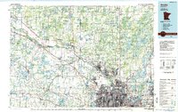
1985 Map of Anoka
USGS Topo · Published 1985About this map
The Mississippi River serves as the primary corridor for development and industry through this mid-1980s landscape, flanked by the growing northern suburbs of the Twin Cities. Urban expansion is most visible in Minneapolis, Brooklyn Park, and Coon Rapids, while the northwestern reaches of the map retain a more agricultural and protected character. The confluence of the Rum River at Anoka highlights the historic importance of these waterways to the region's early settlement patterns.
Find a feature on this map
148 named features on this map. Tap any name to fly to it.
Don’t see what you’re looking for? This feature index may not catch every label — zoom into the map to look around manually.
Map Details
Editions of this 1985 Anoka Map
This is the sole edition of this map. No revisions or reprints were ever made.
Other maps of this area

1896 · Minneapolis
USGS Topo · 1:62,500

1896 · St. Paul
USGS Topo · 1:62,500

1901 · Minneapolis
USGS Topo · 1:62,500

1902 · White Bear
USGS Topo · 1:62,500

1902 · Anoka
USGS Topo · 1:62,500

1905 · Minnetonka
USGS Topo · 1:62,500

1907 · Minnetonka
USGS Topo · 1:62,500

1909 · Rockford
USGS Topo · 1:62,500

1916 · St. Francis
USGS Topo · 1:62,500

1919 · St. Francis
USGS Topo · 1:62,500