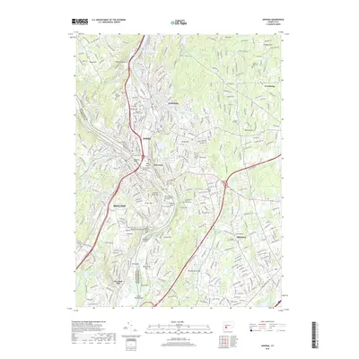
2018 Map of Ansonia
USGS Topo · Published 2018About this map
The Naugatuck River and Housatonic River converge in this densely populated corner of Connecticut, where the industrial and residential boundaries of Ansonia, Derby, and Shelton meet. The 2018 landscape is characterized by a high concentration of memorial and religious sites, including Mount Saint Peters Cem and the Beth Israel Cem of Congregation Or Shalom. These sites, along with older grounds like the Elm Street Cem and Oak Cliff Cem, provide a clear layout of the region's diverse cultural and genealogical history.
Find a feature on this map
364 named features on this map. Tap any name to fly to it.
Don’t see what you’re looking for? This feature index may not catch every label — zoom into the map to look around manually.
Map Details
Editions of this 2018 Ansonia Map
This is the sole edition of this map. No revisions or reprints were ever made.
Other maps of this area

1889 · Derby
USGS Topo · 1:62,500

1891 · Bridgeport
USGS Topo · 1:62,500

1891 · Derby
USGS Topo · 1:62,500

1892 · New Haven
USGS Topo · 1:62,500

1893 · Bridgeport
USGS Topo · 1:62,500

1893 · Derby
USGS Topo · 1:62,500

1920 · Bridgeport
USGS Topo · 1:62,500

1921 · New Haven
USGS Topo · 1:62,500

1943 · New Haven
USGS Topo · 1:31,680

1943 · Naugatuck
USGS Topo · 1:31,680