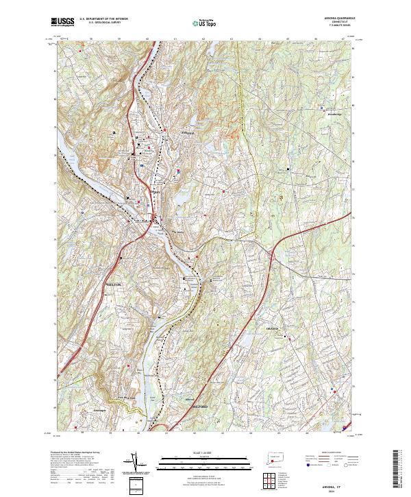
2024 Map of Ansonia
USGS Topo · Published 2024About this map
The confluence of the Housatonic River and the Naugatuck River serves as the industrial and historical heart of this region, anchoring the settlements of Ansonia, Derby, and Shelton. The landscape is defined by the steep valleys of these river systems and the technical infrastructure of the Metro-North Railroad that traces their banks. This modern survey highlights a dense concentration of local heritage sites, particularly in the diverse array of sacred spaces such as the Three Saints Russian Orthodox Cem and the Saint Peter and Saint Paul Ukrainian Greek Catholic Cem, reflecting the area's rich ethnic and immigrant history.
Find a feature on this map
91 named features on this map. Tap any name to fly to it.
Don’t see what you’re looking for? This feature index may not catch every label — zoom into the map to look around manually.
Map Details
Editions of this 2024 Ansonia Map
This is the sole edition of this map. No revisions or reprints were ever made.
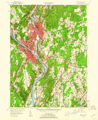
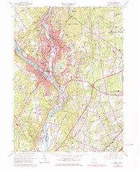
Historical Maps of Ansonia Through Time
3 maps found