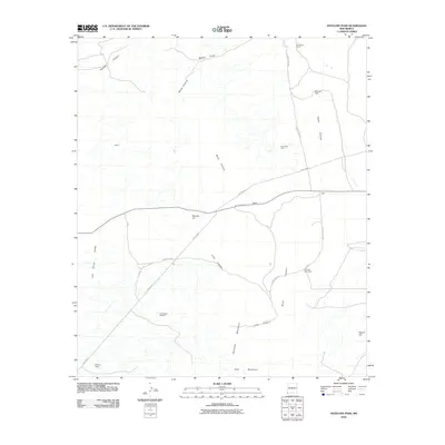
2010 Map of Antelope Pass
USGS Topo · Published 2010About this map
Antelope Pass serves as a critical corridor between the Animas Valley and the San Simon Valley, cutting through the north-south axis of the Peloncillo Mountains. This southwestern New Mexico landscape is defined by its industrial and ranching heritage, featuring several family-named locations such as the Henderson Ranch, Robinson Ranch, and the Kukendall Prop. at the edge of the mountains. Economic activity is visible through the presence of the Pratt Fire Clay Quarry and the Purple Spar Prospect, indicating the region's mineral potential. The topography is shaped by numerous seasonal watercourses, including Long Canyon and Basin Canyon, which drain into the surrounding basins. The presence of Gas Line RD and several county routes highlights the infrastructure necessary for maintaining these remote operations and providing access across the pass near Pratt.
Find a feature on this map
28 named features on this map. Tap any name to fly to it.
Don’t see what you’re looking for? This feature index may not catch every label — zoom into the map to look around manually.
Map Details
Editions of this 2010 Antelope Pass Map
This is the sole edition of this map. No revisions or reprints were ever made.
Other maps of this area

1917 · San Simon
USGS Topo · 1:125,000

1917 · Chiricahua
USGS Topo · 1:125,000

1918 · Pratt
USGS Topo · 1:62,500

1919 · Pratt
USGS Topo · 1:62,500

1919 · Chiricahua
USGS Topo · 1:125,000

1926 · Rodeo
USGS Topo · 1:62,500

1928 · Chenoweth
USGS Topo · 1:62,500

1950 · Vanar
USGS Topo · 1:62,500

1951 · Vanar
USGS Topo · 1:62,500

1954 · Silver City
USGS Topo · 1:250,000