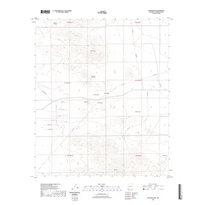
2020 Map of Antelope Pass
USGS Topo · Published 2020About this map
The Peloncillo Mountains dominate this high-desert landscape of Hidalgo County, New Mexico, where the topography is defined by prominent peaks and drainage systems. This 2020 survey highlights Antelope Pass as a key natural corridor, flanked by the distinct elevations of Beacon Hill and Grey Mtn. The map reveals a network of canyons and draws, including Basin Canyon, Black Canyon, and Martin Draw, which channel the region's scarce runoff. Human activity in this arid environment is evidenced by specialized infrastructure like Gas Line Rd and Clay Mine Rd, alongside a naming convention that reflects the local flora and geography, seen in roads like Greasewood Rd, Yucca Ln, and Chiricahua Ln. The layout of these ranch roads and utility corridors suggests a sparsely populated region focused on resource extraction and livestock transit.
Find a feature on this map
31 named features on this map. Tap any name to fly to it.
Don’t see what you’re looking for? This feature index may not catch every label — zoom into the map to look around manually.
Map Details
Editions of this 2020 Antelope Pass Map
This is the sole edition of this map. No revisions or reprints were ever made.
Other maps of this area

1917 · San Simon
USGS Topo · 1:125,000

1917 · Chiricahua
USGS Topo · 1:125,000

1918 · Pratt
USGS Topo · 1:62,500

1919 · Pratt
USGS Topo · 1:62,500

1919 · Chiricahua
USGS Topo · 1:125,000

1926 · Rodeo
USGS Topo · 1:62,500

1928 · Chenoweth
USGS Topo · 1:62,500

1950 · Vanar
USGS Topo · 1:62,500

1951 · Vanar
USGS Topo · 1:62,500

1954 · Silver City
USGS Topo · 1:250,000