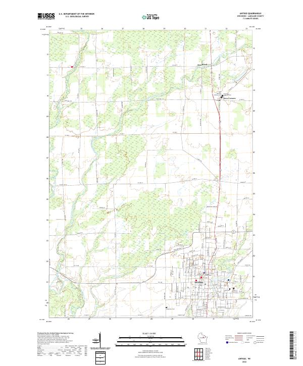
2022 Map of Antigo
USGS Topo · Published 2022About this map
The Langlade County Courthouse serves as the civic heart of Antigo, a city defined by its orderly street grid and its position at the confluence of northern Wisconsin's waterway networks. This survey illustrates a landscape where the Eau Claire River and its multiple branches, including the West Branch Eau Claire River and East Branch Eau Claire River, wind through the surrounding township. The presence of specialized burial grounds like Saint Wencel's Catholic Cem, Bohemian National Cem, and the Bohemian Cem near Neva Corners reflects the specific immigrant heritage and community structures that shaped Langlade County's development. North of the city, the settlement of Deerbrook sits near the riverbanks, while the rural landscape is partitioned by a dense network of country roads such as Co Hwy I and Ormsby Rd.
Find a feature on this map
65 named features on this map. Tap any name to fly to it.
Don’t see what you’re looking for? This feature index may not catch every label — zoom into the map to look around manually.
Map Details
Editions of this 2022 Antigo Map
This is the sole edition of this map. No revisions or reprints were ever made.
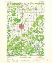
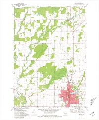
Historical Maps of Ackley Through Time
3 maps found