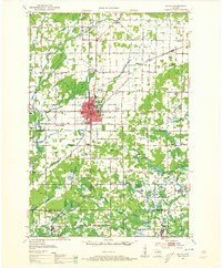
1952 Map of Antigo
USGS Topo · Published 1965About this map
Antigo serves as the central hub of this northern Wisconsin landscape, shown here at the start of the 1950s as a thriving regional center. The city's grid is dense with industrial and civic detail, from the Chicago and North Western rail lines to the County Fairground and Antigo Cem. Surrounding the urban core, the rural townships of Ackley, Neva, and Polar are dotted with a high density of country schools, including the Longfellow Sch and the already Edison Sch (Abandoned), documenting the shifting demographics of rural education in Langlade County.
Find a feature on this map
80 named features on this map. Tap any name to fly to it.
Don’t see what you’re looking for? This feature index may not catch every label — zoom into the map to look around manually.
Map Details
Editions of this 1952 Antigo Map
2 editions found

Other maps of this area

1899 · Wausau
USGS Topo · 1:125,000

1902 · Wausau
USGS Topo · 1:125,000

1940 · Parrish
USGS Topo · 1:48,000

1942 · Elcho
USGS Topo · 1:48,000

1942 · Pearson
USGS Topo · 1:48,000

1950 · Elcho
USGS Topo · 1:48,000

1950 · Lily
USGS Topo · 1:48,000

1950 · Parrish
USGS Topo · 1:48,000

1951 · Doering
USGS Topo · 1:48,000

1952 · Parrish
USGS Topo · 1:48,000