
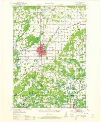
1952 Map of Antigo
USGS Topo · Published 1954About this map
Antigo serves as the central hub of this northern Wisconsin landscape during the early 1950s, surrounded by a dense network of rural school districts and small agricultural settlements. The town's infrastructure includes the County Fairground and the Radio Tower (WATK), while its history is preserved in sites like the Bohemian Cem and Antigo Cem. The region is defined by a heavy concentration of country schools, many already identified as Edison Sch (Abandoned) or Pioneer Sch (Abandoned), signaling a shift in local education patterns.
Find a feature on this map
82 named features on this map. Tap any name to fly to it.
Don’t see what you’re looking for? This feature index may not catch every label — zoom into the map to look around manually.
Map Details
Editions of this 1952 Antigo Map
2 editions found
Other maps of this area

1899 · Wausau
USGS Topo · 1:125,000

1902 · Wausau
USGS Topo · 1:125,000

1940 · Parrish
USGS Topo · 1:48,000

1942 · Elcho
USGS Topo · 1:48,000

1942 · Pearson
USGS Topo · 1:48,000

1950 · Elcho
USGS Topo · 1:48,000

1950 · Lily
USGS Topo · 1:48,000

1950 · Parrish
USGS Topo · 1:48,000

1951 · Doering
USGS Topo · 1:48,000

1952 · Parrish
USGS Topo · 1:48,000