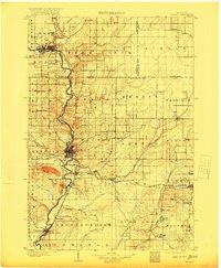
1899 Map of Wausau
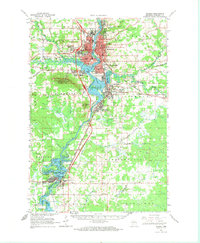
USGS Topo · Published 1956About this map
The Wisconsin River corridor defines the industrial and transportation backbone of Marathon and Lincoln Counties at the close of the 19th century. From Merrill in the north to Mosinee in the south, the river supports a dense network of timber and manufacturing interests, including specialized settlements like Granite Heights and the industrial hub of Wausau. The importance of the logging era is explicitly documented by the presence of the Bull Dessert Logging R R and various junction points like Dessert Junction and Flanner.
Find a feature on this map
72 named features on this map. Tap any name to fly to it.
Don’t see what you’re looking for? This feature index may not catch every label — zoom into the map to look around manually.
Map Details
Editions of this 1899 Wausau Map
This is the sole edition of this map. No revisions or reprints were ever made.
Historical Maps of Wausau Through Time
5 maps found