Loading...
Loading map...2023 Map of Antimony
USGS Topo · Published 2023About this map
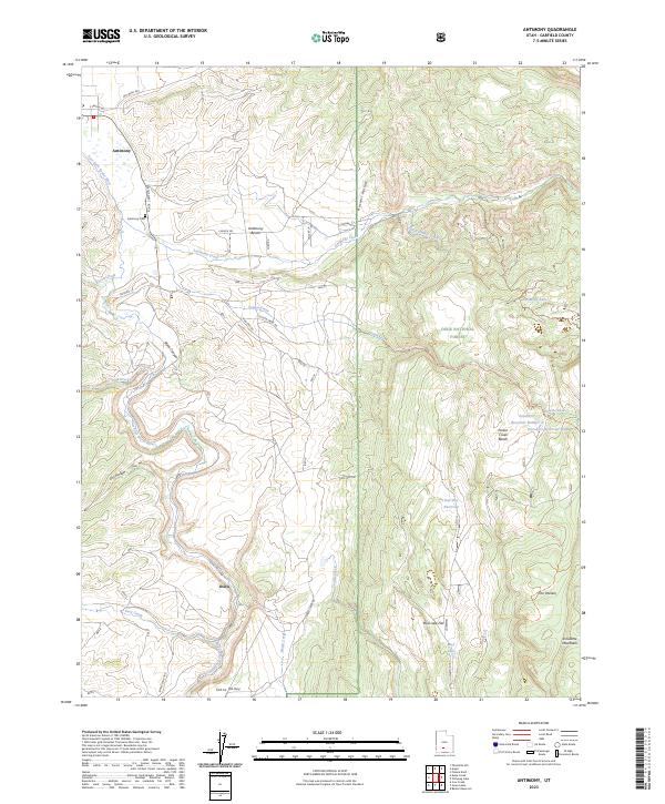
The East Fork Sevier River shapes the western edge of this Garfield County landscape, where the settlement of Antimony sits at the foot of the Escalante Mountains. This high-altitude region is defined by sharp elevation changes, transitioning from the alluvial floor of Johns Valley to the rugged heights of the Dixie National Forest. Local history is anchored by the Antimony Cem and the small locality of Osiris further south.
Find a feature on this map
40 named features on this map. Tap any name to fly to it.
Don’t see what you’re looking for? This feature index may not catch every label — zoom into the map to look around manually.
Map Details
Date Portrayed2023
Date Published2023
PublisherU.S. Geological Survey
Map TypeTopographic
Scale1:24000
Physical Dimensions24 x 29 inches
Editions of this 2023 Antimony Map
This is the sole edition of this map. No revisions or reprints were ever made.
Historical Maps of Antimony Through Time
Featured Locations
Source Details
SourceU.S. Geological Survey
CopyrightPublic Domain