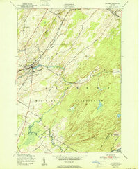
1951 Map of Antwerp
USGS Topo · Published 1951About this map
The village of Antwerp serves as the focal point for this mid-century survey, situated at a junction of the New York Central Railroad and the winding Indian River. This landscape is heavily defined by the presence of the Pine Camp Military Reservation, with its boundaries cutting across the terrain and enclosing facilities like a Rifle Range. Rural infrastructure from an earlier era is still visible through the inclusion of School No 3 and School No 15, as well as the Hillside Cem. The map provides a detailed view of the regional drainage basin, including Matoon Creek and Cold Creek, while historic transit routes like the Russell Turnpike Road and Nauvoo Road reveal the established patterns of travel in northern Jefferson County before modern highway expansion.
Find a feature on this map
35 named features on this map. Tap any name to fly to it.
Don’t see what you’re looking for? This feature index may not catch every label — zoom into the map to look around manually.
Map Details
Editions of this 1951 Antwerp Map
This is the sole edition of this map. No revisions or reprints were ever made.
Other maps of this area

1911 · Antwerp
USGS Topo · 1:62,500

1912 · Hammond
USGS Topo · 1:62,500

1913 · Lake Bonaparte
USGS Topo · 1:62,500

1915 · Gouverneur
USGS Topo · 1:62,500

1916 · Lake Bonaparte
USGS Topo · 1:62,500

1937 · Gouverneur
USGS Topo · 1:62,500

1944 · Hammond
USGS Topo · 1:62,500

1948 · Ogdensburg
USGS Topo · 1:250,000

1949 · Hammond
USGS Topo · 1:62,500

1949 · Antwerp
USGS Topo · 1:62,500