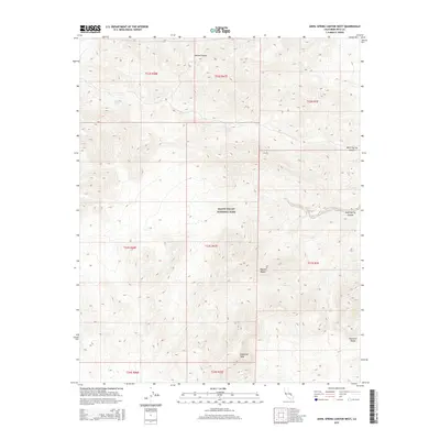
2015 Map of Anvil Spring Canyon West
USGS Topo · Published 2015About this map
Death Valley National Park encompasses this high-altitude desert landscape within the Panamint Range, where the steep topography of the Mojave Desert is punctuated by vital water sources. Critical for survival and early exploration in this arid environment, Grubstake Spring, Warm Spring, and Lost Spring provide rare focal points for human activity and wildlife. The drainage patterns are clearly defined by prominent landforms such as Sugarloaf Peak and the deeply incised paths of Galena Canyon, Warm Spring Canyon, and Anvil Spring Canyon. These canyons served as traditional routes through the mountains, connecting different elevations and providing the only navigable terrain through the rocky interior of Inyo County. The map provides a contemporary record of these enduring geographic features and their relation to the federal park boundaries.
Find a feature on this map
18 named features on this map. Tap any name to fly to it.
Don’t see what you’re looking for? This feature index may not catch every label — zoom into the map to look around manually.
Map Details
Editions of this 2015 Anvil Spring Canyon West Map
This is the sole edition of this map. No revisions or reprints were ever made.
Other maps of this area

1908 · Furnace Creek
USGS Topo · 1:250,000

1908 · Ballarat
USGS Topo · 1:250,000

1910 · Furnace Creek
USGS Topo · 1:250,000

1913 · Ballarat
USGS Topo · 1:250,000

1915 · Searles Lake
USGS Topo · 1:250,000

1933 · Avawatz Mountains
USGS Topo · 1:250,000

1947 · Trona
USGS Topo · 1:250,000

1948 · Trona
USGS Topo · 1:250,000

1948 · Death Valley
USGS Topo · 1:250,000

1950 · Manly Peak
USGS Topo · 1:62,500