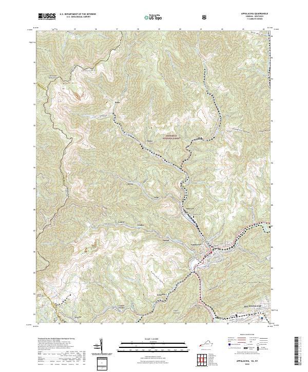
2022 Map of Appalachia
USGS Topo · Published 2022About this map
Jefferson National Forest dominates the high elevations of this Appalachian landscape, where the coal-mining heritage of Wise County is etched into every hollow. The map reveals a dense network of company towns and mountain settlements, including Appalachia, Stonega, and Derby, all connected by the intricate winding of the Powell River and Callahan Creek. The terrain is defined by massive landforms like Black Mountain and Ison Rock Ridge, which shaped the development of transport corridors like the Cumberland To Pennington Gap Trail. At the southern edge, the commercial center of Big Stone Gap sits at the confluence of several valleys, showing the transition from steep ridges to the broader flats near Oak View Cemetery. This documentation preserves the naming of nearly every small drainage and spur, from Sawmill Hollow to Possum Trot Hollow, providing a detailed look at the local geography of southwest Virginia.
Find a feature on this map
99 named features on this map. Tap any name to fly to it.
Don’t see what you’re looking for? This feature index may not catch every label — zoom into the map to look around manually.
Map Details
Editions of this 2022 Appalachia Map
This is the sole edition of this map. No revisions or reprints were ever made.
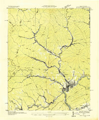
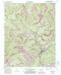
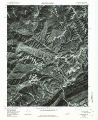
Historical Maps of Appalachia Through Time
4 maps found