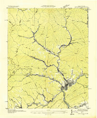
1935 Map of Appalachia
USGS Topo · Published 1935About this map
Stonega Coal and Coke Company control points anchor this 1935 survey of the coal-producing heart of Wise County, Virginia. The map centers on the industrial activity of the era, where the Interstate RR and Southern Railway converge at major facilities like the Interstate Shops and Yards and Southern Yards. Numerous company towns and mining camps are documented in detail, including Roda, Osaka, Derby, and Imboden, each defined by numbered mine shafts such as Stonega Coal No 12 and Stonega Coal No 84.
Find a feature on this map
103 named features on this map. Tap any name to fly to it.
Don’t see what you’re looking for? This feature index may not catch every label — zoom into the map to look around manually.
Map Details
Editions of this 1935 Appalachia Map
This is the sole edition of this map. No revisions or reprints were ever made.
Other maps of this area

1890 · Whitesburg
USGS Topo · 1:125,000

1892 · Whitesburg
USGS Topo · 1:125,000

1894 · Estillville
USGS Topo · 1:125,000

1912 · Pound
USGS Topo · 1:48,000

1913 · Oven Fork
USGS Topo · 1:48,000

1914 · Pound
USGS Topo · 1:62,500

1915 · Whitesburg
USGS Topo · 1:62,500

1920 · Wise
USGS Topo · 1:48,000

1921 · Big Stone Gap
USGS Topo · 1:48,000

1921 · Wise
USGS Topo · 1:62,500