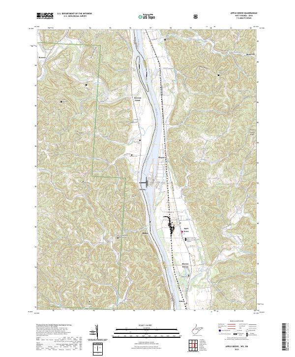
2023 Map of Apple Grove
USGS Topo · Published 2023About this map
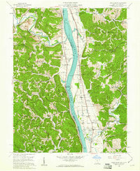
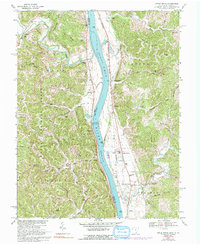
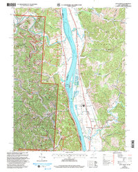
The Ohio River carves a deep valley between Gallia County, Ohio, and Mason County, West Virginia, anchoring a landscape where riverbank settlements and upland ridges define the geography. On the West Virginia side, the bottomlands host communities like Apple Grove, Mercers Bottom, and Hogsett, while Raccoon Island sits prominently in the river channel near Bladen. The area is notably dense with small family and community burial grounds, including the Bethel Methodist Episcopal Cem, Beale Chapel Cem, and Hereford Cem, providing a rich geographic record for genealogists. The terrain transitions sharply from the narrow floodplains to high interior points like Shoestring Ridge and Angel Ridge, with numerous creeks such as Flatfoot Creek and Sixteenmile Creek cutting through the hills to reach the main river. This modern survey also captures the Middle Ohio River Trail (Proposed) Trl running parallel to the water.
Find a feature on this map
96 named features on this map. Tap any name to fly to it.
Don’t see what you’re looking for? This feature index may not catch every label — zoom into the map to look around manually.
Map Details
Editions of this 2023 Apple Grove Map
This is the sole edition of this map. No revisions or reprints were ever made.
Historical Maps of Bladen Through Time
4 maps found