2022 Map of Aquilla
USGS Topo · Published 2022About this map
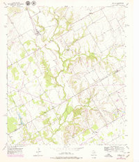
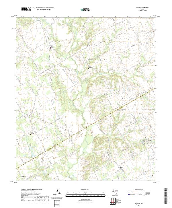
Aquilla serves as a focal point for this landscape near the boundary of Hill and McLennan Counties. The terrain is defined by the winding course of Aquilla Creek, which receives various tributaries such as Cobb Creek and Dead Horse Creek in the north, and Snake Creek further south. The map documents a predominantly rural environment where small communities like Menlow, Wiggins, and Gholson are connected by a network of farm-to-market roads and county lanes. For genealogists and local historians, the sheet preserves the locations of several community burial grounds, including Scotts Chapel Cemetery and a cluster of sites near the southern boundary such as Bold Springs Cemetery and West Brethren Cemetery. The presence of Patten Lake and its feeder, Patten Branch, further illustrates the local drainage patterns that have shaped settlement and agriculture in this portion of Central Texas.
Find a feature on this map
88 named features on this map. Tap any name to fly to it.
Don’t see what you’re looking for? This feature index may not catch every label — zoom into the map to look around manually.
Map Details
Editions of this 2022 Aquilla Map
This is the sole edition of this map. No revisions or reprints were ever made.