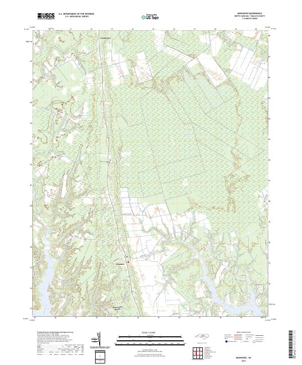
2022 Map of Arapahoe
USGS Topo · Published 2022About this map
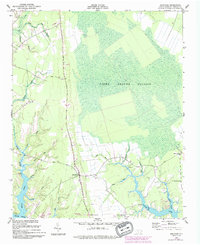
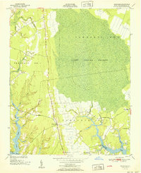
The low-lying coastal plains of Pamlico County are defined by a complex network of tidal guts and winding creeks, where the settlement of Arapahoe serves as a central hub. The landscape is dominated by the Light Ground Pocosin, a distinctive wetland ecosystem that occupies the central portion of the quadrangle, illustrating the historical challenge of drainage and development in this part of North Carolina. Along the southern edge, the terrain transitions to the waterfront communities of Minnesota Beach and the riverine borders of Dawson Creek, which feed into the larger estuary system.
Find a feature on this map
60 named features on this map. Tap any name to fly to it.
Don’t see what you’re looking for? This feature index may not catch every label — zoom into the map to look around manually.
Map Details
Editions of this 2022 Arapahoe Map
This is the sole edition of this map. No revisions or reprints were ever made.
Historical Maps of Minnesott Beach Through Time
3 maps found