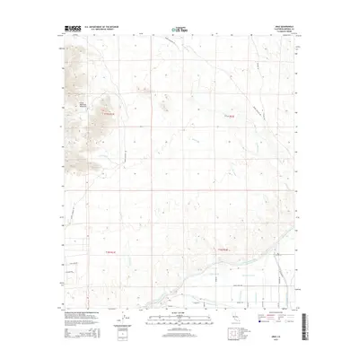
2015 Map of Araz
USGS Topo · Published 2015About this map
The Cargo Muchacho Mountains dominate the northwestern corner of this landscape, giving way to the complex irrigation networks of the Colorado River basin. In the early 21st century, the settlement of Araz sits at the heart of a region defined by its desert hydrology and modern engineering. The massive All-American Canal cuts through the southern reaches of the quadrangle, supported by an intricate system of laterals including the Tenino Lateral, Ypsilanti Lateral, and Comanche Lateral.
Find a feature on this map
33 named features on this map. Tap any name to fly to it.
Don’t see what you’re looking for? This feature index may not catch every label — zoom into the map to look around manually.
Map Details
Editions of this 2015 Araz Map
This is the sole edition of this map. No revisions or reprints were ever made.
Other maps of this area

1903 · Yuma
USGS Topo · 1:125,000

1905 · Yuma
USGS Topo · 1:125,000

1940 · Yuma
USGS Topo · 1:62,500

1942 · Yuma
USGS Topo · 1:250,000

1945 · Picacho Peak
USGS Topo · 1:62,500

1945 · Yuma
USGS Topo · 1:62,500

1951 · Picacho Peak
USGS Topo · 1:62,500

1952 · Araz
USGS Topo · 1:24,000

1952 · Yuma East
USGS Topo · 1:24,000

1952 · Yuma West
USGS Topo · 1:24,000