
1940 Map of Yuma
USGS Topo · Published 1956About this map
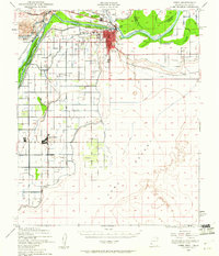
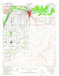
The Colorado River and Gila River converge at a strategic desert crossroads on this 1940 survey, documenting the early development of the Lower Colorado River Valley. The city of Yuma serves as the hub of this arid landscape, featuring vital community infrastructure such as the Yuma General Hospital, the Indian Sch, and the Yuma Cem. The map illustrates a complex network of man-made waterways, including the Alamo Canal, Main Canal, and A Canal, which transformed the surrounding Yuma Desert into productive agricultural land.
Find a feature on this map
29 named features on this map. Tap any name to fly to it.
Don’t see what you’re looking for? This feature index may not catch every label — zoom into the map to look around manually.
Map Details
Editions of this 1940 Yuma Map
3 editions found
Other maps of this area

1903 · Yuma
USGS Topo · 1:125,000

1905 · Yuma
USGS Topo · 1:125,000

1926 · Fortuna
USGS Topo · 1:62,500

1929 · Fortuna
USGS Topo · 1:62,500

1929 · Laguna
USGS Topo · 1:62,500

1942 · Yuma
USGS Topo · 1:250,000

1943 · Laguna
USGS Topo · 1:62,500

1945 · Picacho Peak
USGS Topo · 1:62,500

1945 · Yuma
USGS Topo · 1:62,500

1951 · Picacho Peak
USGS Topo · 1:62,500