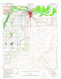
1940 Map of Yuma
USGS Topo · Published 1966About this map
The Colorado River and Gila River meet near the growing desert hub of Yuma, defining a complex borderland where Arizona, California, and Mexico converge. This 1940 survey illustrates an intensive irrigation network essential to the region's agricultural development, featuring the Alamo Canal, Main Canal, and West Main Canal which transformed the arid floor of the Yuma Desert. To the west, the Inter-California route and Southern Pacific railroad underscore the area's importance as a transportation corridor.
Find a feature on this map
30 named features on this map. Tap any name to fly to it.
Don’t see what you’re looking for? This feature index may not catch every label — zoom into the map to look around manually.
Map Details
Editions of this 1940 Yuma Map
3 editions found
Other maps of this area

1903 · Yuma
USGS Topo · 1:125,000

1905 · Yuma
USGS Topo · 1:125,000

1926 · Fortuna
USGS Topo · 1:62,500

1929 · Fortuna
USGS Topo · 1:62,500

1929 · Laguna
USGS Topo · 1:62,500

1940 · Yuma
USGS Topo · 1:62,500

1942 · Yuma
USGS Topo · 1:250,000

1943 · Laguna
USGS Topo · 1:62,500

1945 · Picacho Peak
USGS Topo · 1:62,500

1945 · Yuma
USGS Topo · 1:62,500