
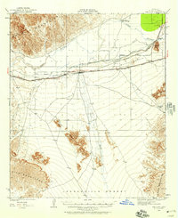
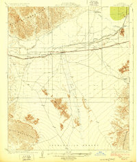
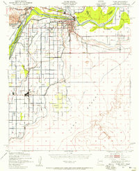
1926 Map of Fortuna
USGS Topo · Published 1956About this map
The Fortuna Mine anchors the southern portion of this rugged Yuma County landscape, reflecting the era's desert mining activity within the Gila Mountains. This survey, updated in the mid-1920s, documents a transit corridor defined by the Gila River and the Southern Pacific railroad, which connect small outposts like Blaisdell, Fortuna, and Ligurta. The terrain is marked by sharp elevation changes, from the river valley floor to the prominent peaks of the Muggins Mountains and distinctive landmarks like Clothos Temple.
Find a feature on this map
15 named features on this map. Tap any name to fly to it.
Don’t see what you’re looking for? This feature index may not catch every label — zoom into the map to look around manually.
Map Details
Editions of this 1926 Fortuna Map
This is the sole edition of this map. No revisions or reprints were ever made.
Other maps of this area

1903 · Yuma
USGS Topo · 1:125,000

1905 · Yuma
USGS Topo · 1:125,000
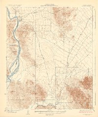
1926 · Wellton
USGS Topo · 1:62,500
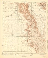
1929 · Fortuna
USGS Topo · 1:62,500
1929 · Laguna
USGS Topo · 1:62,500
1929 · Wellton
USGS Topo · 1:62,500
1940 · Yuma
USGS Topo · 1:62,500

1942 · Yuma
USGS Topo · 1:250,000
1943 · Laguna
USGS Topo · 1:62,500

1945 · Picacho Peak
USGS Topo · 1:62,500