
1929 Map of Wellton
USGS Topo · Published 1929About this map
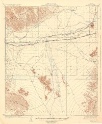
The Gila River corridor serves as the primary artery for settlement and transport across this arid landscape, flanked by the Muggins Mountains to the north and the Lechuguilla Desert to the south. Central to the map is the town of Wellton, a vital station along the Southern Pacific railroad, which parallels the Gila Valley. This era shows early desert infrastructure, from the Gas Water Canal to the Electric Bend irrigation works. Smaller railway stops and settlements like Adonde, Asher, and Tacna dot the line, representing the thin ribbon of habitation made possible by the river and rail connection. The presence of Radium Hot Springs and Baker Tanks highlights the critical importance of water sources in the southwestern desert, while landmarks like Antelope Hill and the Baker Peaks provide orientation across the vast Wellton Mesa.
Find a feature on this map
22 named features on this map. Tap any name to fly to it.
Don’t see what you’re looking for? This feature index may not catch every label — zoom into the map to look around manually.
Map Details
Editions of this 1929 Wellton Map
3 editions found
Other maps of this area

1926 · Fortuna
USGS Topo · 1:62,500

1926 · Wellton
USGS Topo · 1:62,500

1926 · Mohawk
USGS Topo · 1:62,500

1928 · Mohawk
USGS Topo · 1:62,500

1928 · Norton
USGS Topo · 1:62,500

1929 · Fortuna
USGS Topo · 1:62,500

1929 · Laguna
USGS Topo · 1:62,500

1929 · Norton
USGS Topo · 1:62,500

1942 · Yuma
USGS Topo · 1:250,000

1943 · Laguna
USGS Topo · 1:62,500