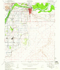
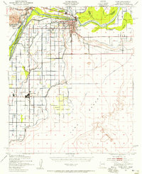
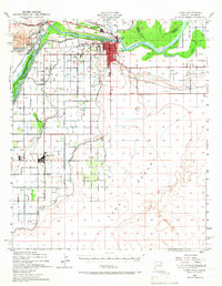
1940 Map of Yuma
USGS Topo · Published 1960About this map
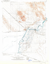
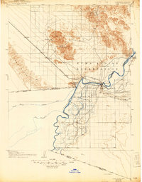
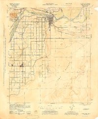
The Colorado River and Gila River define this desert landscape, where Arizona, California, and Mexico converge. The city of Yuma stands as a vital hub at this tri-state junction, shown here at a time when the Southern Pacific railroad and an intricate network of irrigation canals, including the Alamo Canal and West Main Canal, powered the region's agricultural expansion. Beyond the urban center, smaller settlements like Somerton, Winterhaven, and Andrade are surrounded by gridded farmland that terminates abruptly at the edge of the Yuma Desert.
Find a feature on this map
27 named features on this map. Tap any name to fly to it.
Don’t see what you’re looking for? This feature index may not catch every label — zoom into the map to look around manually.
Map Details
Editions of this 1940 Yuma Map
3 editions found
Historical Maps of Yuma Through Time
6 maps found