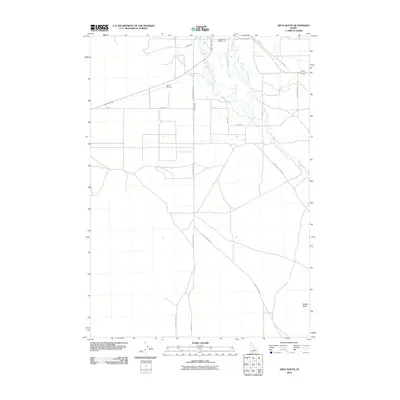
2010 Map of Arco South
USGS Topo · Published 2010About this map
The Big Lost River defines this high-desert Idaho landscape as it winds through a network of waterways and irrigation infrastructure south of the town of Arco. The map captures the intricate relationship between water and the arid terrain, showing the meandering path of Ferris Slough and the engineered utility of Munsey Ditch. To the west, the Arco Airport serves as a modern waypoint, while the southeastern corner is punctuated by the distinct elevation of Sixmile Butte. This 2010 survey illustrates a grid of rural routes and long-distance desert tracks, including the Arco-Minidoka Rd and Huddles Hole Rd, which trace the historic movement of people across the Butte County sagebrush. The convergence of these primitive roads and waterways reveals a landscape managed for aviation, agriculture, and transit in the shadow of the Lost River Range.
Find a feature on this map
17 named features on this map. Tap any name to fly to it.
Don’t see what you’re looking for? This feature index may not catch every label — zoom into the map to look around manually.
Map Details
Editions of this 2010 Arco South Map
This is the sole edition of this map. No revisions or reprints were ever made.
Other maps of this area

1955 · Idaho Falls
USGS Topo · 1:250,000

1958 · Idaho Falls
USGS Topo · 1:250,000

1972 · Quaking Aspen Butte
USGS Topo · 1:24,000

1972 · Arco North
USGS Topo · 1:24,000

1972 · Arco South
USGS Topo · 1:24,000

1972 · Butte City
USGS Topo · 1:24,000

1972 · Nichols Reservoir
USGS Topo · 1:24,000

1972 · Arco Hills
USGS Topo · 1:24,000

1972 · Fingers Butte
USGS Topo · 1:24,000

1972 · Appendicitis Hill
USGS Topo · 1:24,000