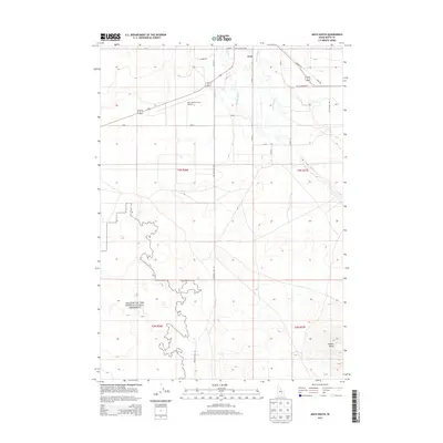
2013 Map of Arco South
USGS Topo · Published 2013About this map
Craters Of The Moon National Preserve dominates the southwestern portion of this landscape, its irregular boundary marking where the volcanic terrain meets the high desert floor. Just south of Arco, the land is shaped by an intricate system of water management where the Big Lost River is supplemented by the Arco Canal, Munsey Ditch, and Ferris Slough. This network supports the agricultural and transit corridor that includes the Arco-Butte County Airport and a grid of rural roads like Arco Minidoka Rd. To the east, the elevation rises toward Sixmile Butte, providing a sharp contrast to the flat basin of the river valley. The map reveals the tension between the preserved volcanic wilderness and the irrigation-dependent ranching and aviation infrastructure of Butte County.
Find a feature on this map
19 named features on this map. Tap any name to fly to it.
Don’t see what you’re looking for? This feature index may not catch every label — zoom into the map to look around manually.
Map Details
Editions of this 2013 Arco South Map
This is the sole edition of this map. No revisions or reprints were ever made.
Other maps of this area

1955 · Idaho Falls
USGS Topo · 1:250,000

1958 · Idaho Falls
USGS Topo · 1:250,000

1972 · Quaking Aspen Butte
USGS Topo · 1:24,000

1972 · Arco North
USGS Topo · 1:24,000

1972 · Arco South
USGS Topo · 1:24,000

1972 · Butte City
USGS Topo · 1:24,000

1972 · Nichols Reservoir
USGS Topo · 1:24,000

1972 · Arco Hills
USGS Topo · 1:24,000

1972 · Fingers Butte
USGS Topo · 1:24,000

1972 · Appendicitis Hill
USGS Topo · 1:24,000