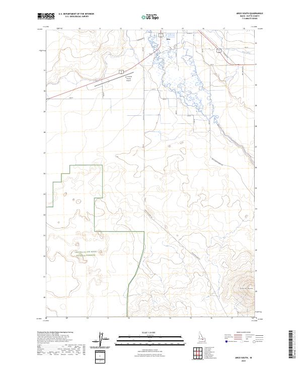
2023 Map of Arco South
USGS Topo · Published 2023About this map
The northern reaches of the Craters of the Moon National Preserve dominate the southwestern quadrant of this Butte County landscape, where the volcanic terrain meets the agricultural valley floor. The settlement of Arco sits at the northern edge, serving as a gateway where the high desert terrain transitions into a complex network of water management. This irrigation infrastructure is clearly defined by the Arco Canal, Munsey Ditch, and Ferris Slough, which divert the waters of the Big Lost River to support local ranching and farming. To the southeast, the prominent rise of Sixmile Butte stands as a landmark against the lower valley, while the Arco-Butte County Airport and routes like the Arco-Minidoka Rd illustrate the modern transportation framework connecting this remote region.
Find a feature on this map
23 named features on this map. Tap any name to fly to it.
Don’t see what you’re looking for? This feature index may not catch every label — zoom into the map to look around manually.
Map Details
Editions of this 2023 Arco South Map
This is the sole edition of this map. No revisions or reprints were ever made.
Other maps of this area

1955 · Idaho Falls
USGS Topo · 1:250,000

1958 · Idaho Falls
USGS Topo · 1:250,000

1972 · Quaking Aspen Butte
USGS Topo · 1:24,000

1972 · Arco North
USGS Topo · 1:24,000

1972 · Arco South
USGS Topo · 1:24,000

1972 · Butte City
USGS Topo · 1:24,000

1972 · Nichols Reservoir
USGS Topo · 1:24,000

1972 · Arco Hills
USGS Topo · 1:24,000

1972 · Fingers Butte
USGS Topo · 1:24,000

1972 · Appendicitis Hill
USGS Topo · 1:24,000