
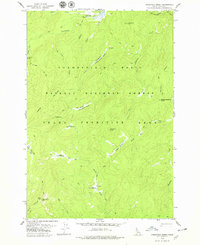
1978 Map of Arctic Point
USGS Topo · Published 1978About this map
Arctic Point Lookout Tower 7518 stands as the high sentinel of this wilderness, overlooking a landscape defined by the drainage of the Chamberlain Basin. Surveyed in the late 1970s, the terrain within the Payette National Forest and the Idaho Primitive Area remains largely untouched, characterized by a complex network of seasonal water sources and meadows. Notable riparian features such as Hot Springs Meadow and Queen Creek Meadow provide rare breaks in the high-elevation ridges. The map meticulously traces a system of Pack Trails, which serve as the primary conduits through the backcountry, connecting sites like Quaking Aspen Springs and various remote campsites. This survey captures a moment of preserved wilderness, documenting the essential geography of the McCalla Ridge and the convergence of creeks like Arctic Creek and Chamberlain Creek before modern forest management practices evolved.
Find a feature on this map
23 named features on this map. Tap any name to fly to it.
Don’t see what you’re looking for? This feature index may not catch every label — zoom into the map to look around manually.
Map Details
Editions of this 1978 Arctic Point Map
This is the sole edition of this map. No revisions or reprints were ever made.
Other maps of this area

1956 · Elk City
USGS Topo · 1:250,000

1960 · Elk City
USGS Topo · 1:250,000

1974 · Meadow Of Doubt
USGS Topo · 1:24,000

1978 · Dennis Mtn
USGS Topo · 1:24,000

1978 · Hida Point
USGS Topo · 1:24,000

1978 · Wapiti Creek
USGS Topo · 1:24,000

1978 · Sheep Hill
USGS Topo · 1:24,000
1978 · Lodgepole Creek
USGS Topo · 1:24,000

1978 · Devils Teeth Rapids
USGS Topo · 1:24,000
1979 · Cold Meadows
USGS Topo · 1:24,000