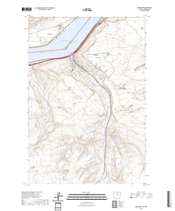
2024 Map of Arlington
USGS Topo · Published 2024About this map
The Columbia River defines this stretch of the border between Oregon and Washington, where the town of Arlington serves as a hub for the surrounding plateau. The settlement is characterized by a precise grid of streets including Main St, Cottonwood St, and Railroad Ave, flanked by the BNSF Railway corridor. Across the river in Washington, the community of Roosevelt sits near the banks of Lake Umatilla. The landscape away from the water is deeply etched by drainage patterns such as Alkali Canyon and Jones Canyon, which cut through the high ground of Hurlburt Flats. Local history and infrastructure are represented by the Arlington Masonic Cem and the Arlington Municipal Airport, while the presence of the China Ditch suggests the historical importance of water management in this arid agricultural region.
Find a feature on this map
35 named features on this map. Tap any name to fly to it.
Don’t see what you’re looking for? This feature index may not catch every label — zoom into the map to look around manually.
Map Details
Editions of this 2024 Arlington Map
This is the sole edition of this map. No revisions or reprints were ever made.
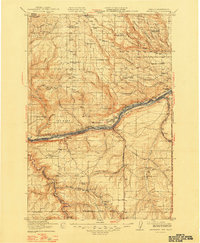
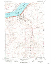
Historical Maps of Arlington Through Time
3 maps found